Daily Forecast | The latest from First Alert Chief Meteorologist Riley Hale
FIRST ALERT ISSUED for risk of TORNADOES tonight through early Friday. Stay weather-aware!
AUGUSTA, Ga. (WRDW/WAGT) - TORNADO WATCH IN EFFECT FOR AIKEN, ALLENDALE, BARNWELL, AND BAMBERG COUNTY UNTIL 7 AM. A WATCH MEANS CONDITIONS ARE FAVORABLE FOR TORNADOS TO FORM. All eyes are on Nicole and the potential for tornadoes in the CSRA this evening through Friday morning.
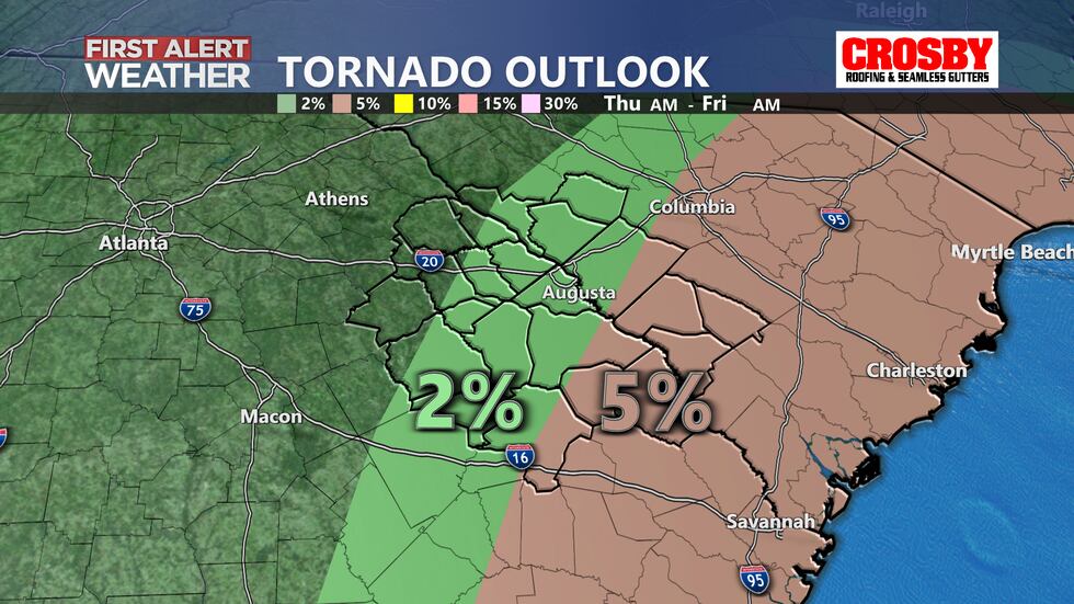
The greatest impact we will likely see from Nicole is a tornado threat from tropical rainbands moving through later this evening into early Friday. The greatest tornado risk in the CSRA is going to be for areas along and south of I-20. Stay weather aware through Friday morning. Keep your cell phone charged and volume up to receive alerts before heading to bed. The Storm Prediction Center has the CSRA under a marginal to slight risk for tornadoes this afternoon through Friday morning.
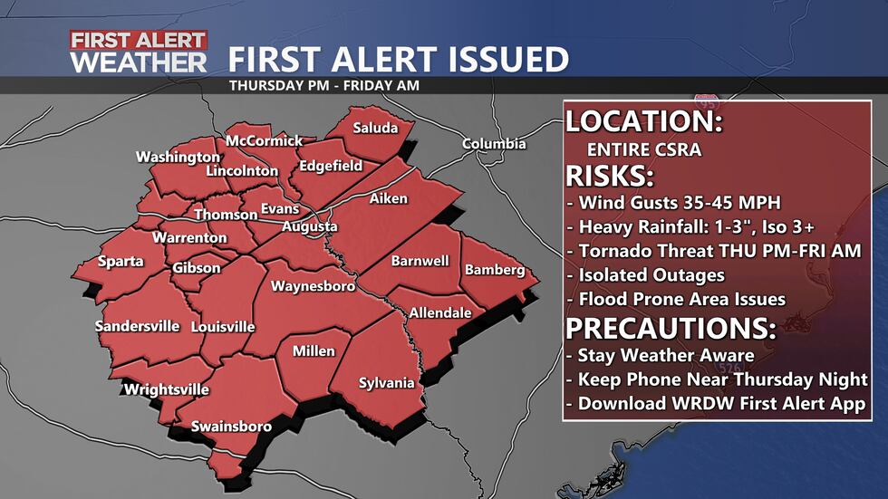
Heavy rain from Nicole will bring over 1″ in most areas, and likely between 1-2″ based on the latest guidance. Winds will peak Thursday afternoon into early Friday as the center of Nicole gets closest to the CSRA. Peak wind gusts are expected to be between 35-45 mph. Temperatures during the day Thursday and Friday will hover in the 60s and 70s.
Nicole will quickly move away from the region Friday afternoon/evening, and we do look dry for high school football games Friday evening.
Temperatures will be more seasonal Saturday with highs in the low to mid-70s. Sunday will be cooler than average with morning lows Sunday in the low 40s and highs in the 60s. Keep it here for updates.
Copyright 2022 WRDW/WAGT. All rights reserved.


