Daily forecast | From First Alert Chief Meteorologist Riley Hale
Scattered showers and storms expected Wednesday. Rain lingers into Wednesday night and Thursday morning.
AUGUSTA, Ga. (WRDW/WAGT) - Smoke from wildfires in Canada is making it’s way to the Southeast and will continue to bring us hazy skies through today. Scattered showers and a few storms possible Wednesday associated with low pressure forming off the Southeast Coast. Scattered showers and few storms possible again Thursday as coastal low pressure rides the Carolina Coast. Bringing back more heat and humidity for the weekend with chance for afternoon storms.
Mostly clear this evening with increasing clouds overnight. Temperatures will be seasonal tonight and drop to the mid-60s by early Wednesday.
Scattered showers and few rumbles of thunder are expected Wednesday as an area of low pressure starts to develop off the Southeast Coast. Southern CSRA counties will see the rain first as it moves inland from the coast. Wind will be out of the east-southeast 8-12 mph with occasional gusts up to 20 mph. Highs will be slightly cooler in the mid-80s.
The coastal low by Thursday will continue to develop and ride up the Carolina Coast. Scattered showers are expected with the chance of a few storms, mainly hit or miss showers in the morning and then chance for storms by the afternoon. With cloudy skies most of the day, highs will be below normal in the low 80s. Rain could be heavy at times prompting a marginal risk for flash flooding.
Heat, humidity, and afternoon storm chances return by the end of the work week. Scattered showers and storms are possible Friday, Saturday, and Sunday afternoons.
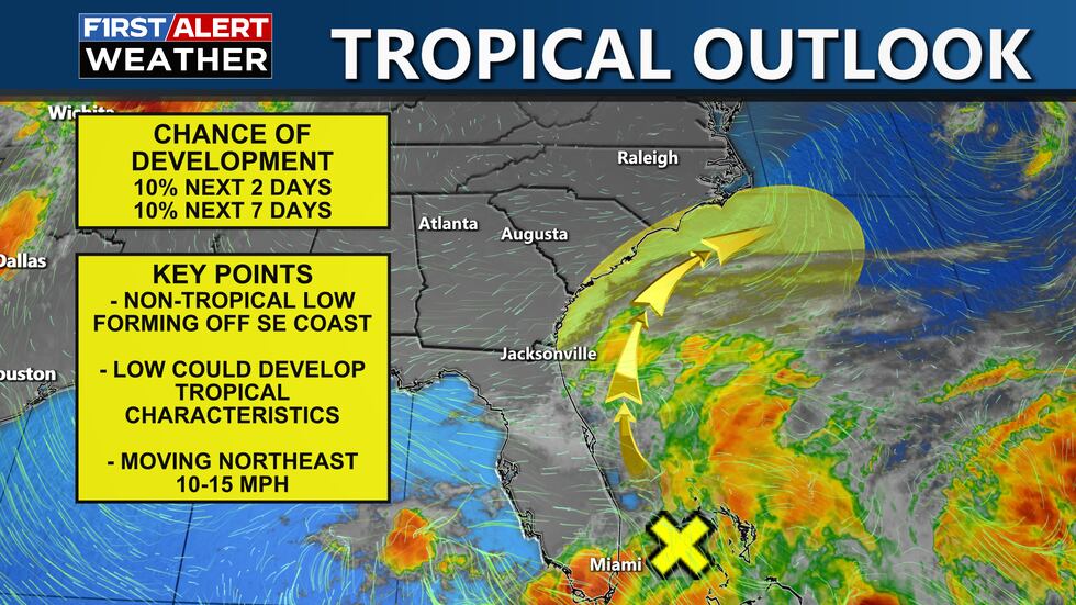
The National Hurricane Center is monitoring a non-tropical area of low pressure over the next few days, but only a 10% chance right now of developing into a tropical cyclone. Latest from NHC, “A non-tropical area of low pressure is forecast to form near the southeastern U.S. coast along a frontal boundary during the next couple of days. Environmental conditions appear only marginally conducive for the low to gradually develop some subtropical or tropical characteristics later this week if it forms or moves offshore the coast. The low is forecast to move east of North Carolina over the Atlantic by late Friday or Saturday.* Formation chance through 48 hours...low...10 percent.* Formation chance through 7 days...low...10 percent.”
Keep it here for updates throughout the week!
Copyright 2025 WRDW/WAGT. All rights reserved.


