Daily forecast | From First Alert Meteorologist Tim Strong
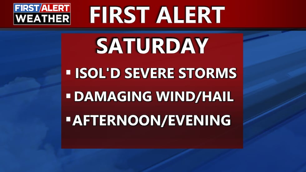
FIRST ALERT for possible severe storms Saturday! Damaging winds and hail the main threats. Hot and muggy weekend.
AUGUSTA, Ga. (WRDW/WAGT) - Scattered showers and a few storms possible today associated with low pressure off the Southeast Coast. Scattered showers and few storms possible again Thursday as coastal low pressure rides the Carolina Coast. Bringing back more heat and humidity for the weekend with chance for afternoon storms.
The coastal low will continue to ride up the Carolina Coast. Scattered showers are expected with the chance of a few storms, mainly hit or miss showers and storms by the afternoon. With cloudy skies most of the day, highs will be below normal in the mid-80s. Wind will be out of the northwest between 5-10 mph with higher gusts possible.
Friday looks mostly dry and hot during the day, but there will be the chance of a few isolated storms by the afternoon. Highs will top out in the low 90s with hotter feel like temperatures thanks to humidity on the rise. Wind will be out of the southwest between 5-10 mph.
We’ve issued a FIRST ALERT for the possibility of severe storms Saturday. Main threats will be damaging winds and hail. Timeline looks to be between 4PM - 9PM.
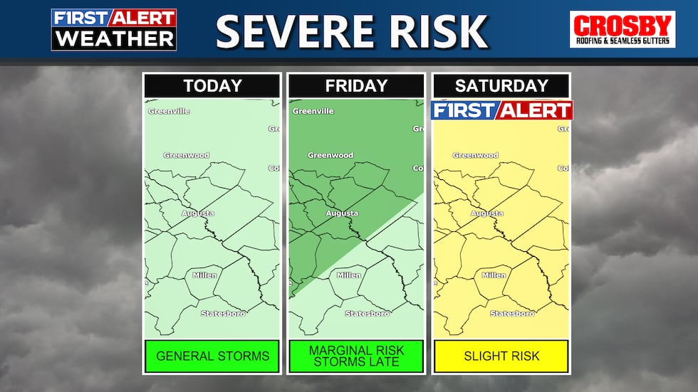
The Storm Prediction Center has the CSRA under the chance for severe weather Friday night and Saturday. Damaging straight line winds and isolated large hail look possible in any storms that form this weekend thanks to high amounts of convective energy in our atmosphere and an incoming cold front. Make sure to stay weather aware with outdoor plans! Highs will be hot Saturday in the low 90s and feel like temperatures could get close to 100.
Sunday will continue the threat for heavy rain and storms. There is a marginal risk for flash flooding Sunday - minor flooding issues possible for flood prone areas. Highs will be seasonal in the upper 80s. Keep it here for updates throughout the week!
Copyright 2025 WRDW/WAGT. All rights reserved.


